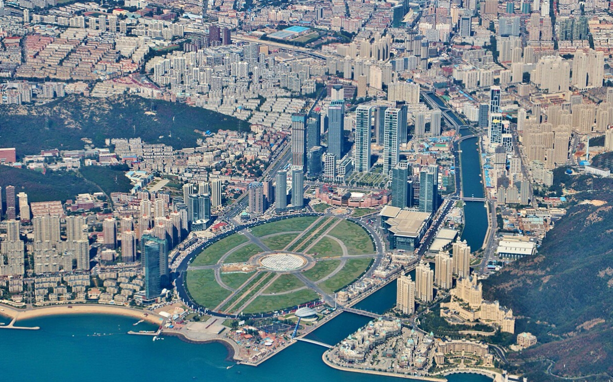
Liaoning Province is a provincial-level administrative region of the People’s Republic of China, abbreviated as “Liao,” with its capital in Shenyang. Located in the southern part of Northeast China, Liaoning covers a land area of 148,700 square kilometers and a sea area of 150,000 square kilometers, with a coastline spanning 2,290 kilometers. As of July 2024, the province administers 14 prefecture-level cities, 59 districts, 16 county-level cities, 17 counties, and 8 autonomous counties. The provincial government is located at 45-9 Beiling Street, Huanggu District, Shenyang. By the end of 2023, Liaoning’s permanent population was approximately 41.82 million. The main spoken dialects include Beijing Mandarin, Northeastern Mandarin, and Jiao-Liao Mandarin, along with remaining minority languages such as Manchu and Mongolian.

The province features diverse topography with a general layout described as “six mountains, one river, three parts farmland,” with high elevations in the north and descending plains in the central and southern regions, characterized by a temperate monsoon climate. Liaoning’s administrative history dates back to the Spring and Autumn period when the Yan State established the Liaodong and Liaoxi commanderies. During the Yuan Dynasty, Liaoyang Province marked the beginning of a formal provincial structure in the area. In 1907, the Qing government carried out significant reforms, establishing Fengtian Province, later renamed Liaoning in 1929. In 1954, the provinces of Liaodong and Liaoxi were merged to form present-day Liaoning Province.
Strategically situated at the center of the Bohai Sea and Northeast Asia economic zones, Liaoning is a crucial industrial base in China. In 2023, the province achieved a GDP of 3,020.9 billion yuan. Liaoning boasts a well-developed transportation network, being the first in China to connect all land-based counties by expressways and hosting major ports like Dalian, Yingkou, and Dandong, alongside eight civil aviation airports in cities like Shenyang, Dalian, and Anshan. Liaoning has a distinctive cultural heritage with six World Heritage sites, including the Jiuliancheng Great Wall and Shenyang’s Imperial Palace. The province also offers abundant tourism resources, with 577 nationally rated scenic sites, including six 5A-rated sites.

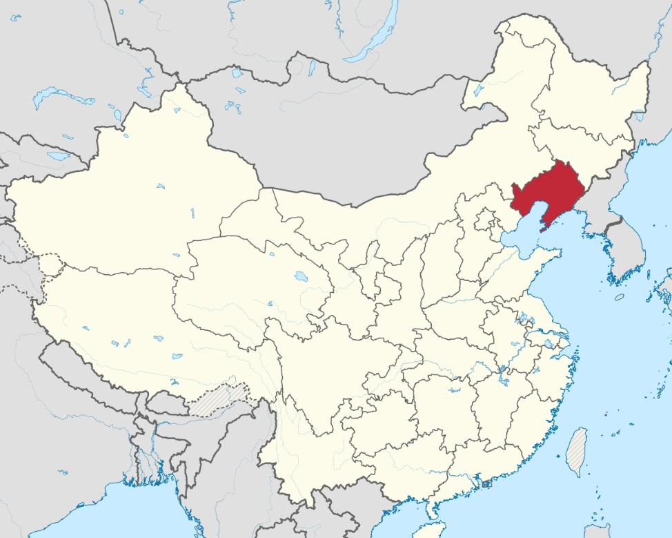
Map showing the location of Liaoning Province
Complete Map of China – Click Here
| Name | Content |
|---|---|
| Chinese Name | Liaoning Province |
| English Name | Liaoning Province |
| Nicknames | Fengtian, Eldest Son of the Republic, Eastern Ruhr |
| Administrative Division Code | 210000 |
| Administrative Region Category | Province |
| Region Affiliation | People’s Republic of China |
| Geographical Location | Southern part of Northeast China |
| Area | 148,700 square kilometers (land area) |
| Subordinate Regions | 14 prefecture-level cities, 59 municipal districts, 16 county-level cities, 17 counties, and 8 autonomous counties |
| Government Residence | 45-9 Beiling Street, Huanggu District, Shenyang City |
| Postal Code | 110000 – 125000 |
| Climate | Temperate monsoon climate |
| Population | 41.82 million (resident population at the end of 2023) |
| Famous Scenic Spots | Jiukoukou Great Wall, Wunüshan Mountain City, Shenyang Imperial Palace, Anshan Qianshan Mountain, Benxi Shuiku Cave |
| Airports | Shenyang Taoxian International Airport, Dalian Zhoushuizi International Airport, Yingkou Lanqi Airport, Anshan Teng’ao Airport, etc. |
| Railway Stations | Shenyang Station, Shenyang North Station, Dalian Station, Anshan Station, Jinzhou Station, etc. |
| License Plate Codes | Liaoning A – Liaoning P |
| Regional GDP | 3,020.94 billion yuan (in 2023) |
| Abbreviation | Liao |
| Provincial Capital | Shenyang City |
| Ethnic Groups | Manchu, Mongolian, Hui, Korean, Xibe and others |
| Dialects | Beijing Mandarin, Northeast Mandarin, Jiaoliao Mandarin |
| Government Official Website | https://www.ln.gov.cn/ |
| Ports | Dalian Port, Yingkou Port, etc. |
I. NAME ORIGIN
Liaoning Province derives its name from the phrase “Liao River Basin, Forever Peaceful.” In 1264, during the Yuan Dynasty, the Liaoyang Provincial Administration was established, marking the beginning of provincial governance in the Liaoning region. In 1907, significant reforms were implemented in the governance of Northeast China by the Qing Dynasty, leading to the abolition of military governors and the establishment of the Fengtian Province. On March 1, 1929, under an order from the National Government in Nanjing, Fengtian Province was renamed Liaoning Province, and the provincial government also changed its name accordingly.
II. Geographical Location
Liaoning Province is located in the southern part of Northeast China, between 118°53′ to 125°46′ east longitude and 38°43′ to 43°26′ north latitude. Liaoning Province is bordered by the Yellow Sea and the Bohai Sea to the south. The Liaodong Peninsula is obliquely inserted between the two seas. Across the Bohai Strait, it echoes the Shandong Peninsula from afar. It is bordered by Hebei Province to the southwest, adjacent to Inner Mongolia Autonomous Region to the northwest, adjacent to Jilin Province to the northeast, and separated from North Korea by the Yalu River to the southeast. Liaoning Province has a land area of 148,700 square kilometers and a sea area of 150,000 square kilometers. The total length of the continental coastline is 2,290 kilometers, in an “N” shape, accounting for 12% of the country’s total and ranking fifth.
III. Climate
Liaoning Province is located in the southern half of the middle latitudes, on the east coast of the Eurasian continent. It has a temperate continental monsoon climate with simultaneous rain and heat, abundant sunshine, and distinct four seasons. The annual average temperature is 8.8°C, gradually decreasing from the coast to the inland, with a temperature difference of 5°C between the north and the south. The annual average precipitation is 648 millimeters, increasing from northwest to southeast. In winter, it is mainly dominated by northwest winds, long and cold. In summer, there are mostly southeast winds, hot and rainy. In spring, there is little rain and strong winds. In autumn, it is short and sunny. The annual total solar radiation is between 100-200 calories/square centimeter, and the annual sunshine hours are between 2100-2900 hours. The annual average temperature is between 5.2°C and 11.7°C. The highest temperature is around 30°C above zero, and the lowest temperature is around 30°C below zero. The annual average precipitation is 400 – 970 millimeters, and the average frost-free period is 130 – 200 days. Generally, the frost-free period is more than 150 days.
